Study: Bell Gardens recorded 1,620 crashes in five years

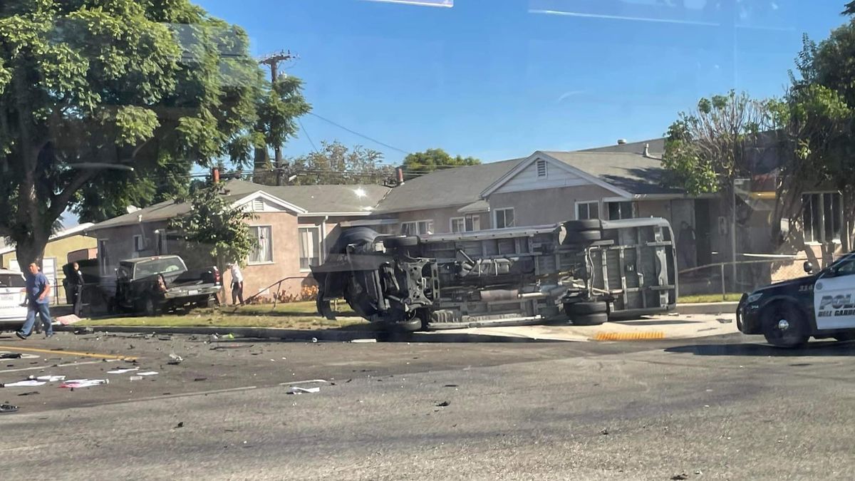
BELL GARDENS, CA — After 1,620 crashes in five years, the Bell Gardens City Council has adopted a new safety plan aimed at reducing crashes and securing future grant funding for the city.
The report found 1,620 collisions occurred on Bell Gardens streets between March 2020 and December 2024, including dozens that left people dead or seriously injured. The deadliest year of the study period was 2022, when Bell Gardens recorded 16 crashes resulting in death or serious injury. Overall, the city averaged about nine such crashes per year.
Topping the city's crash list was the intersection of Eastern Avenue and Florence Avenue, where 80 collisions were recorded during the study period. Clara Street and Eastern Avenue came in second with 51 crashes, while Eastern Avenue and Gage Avenue and Gage Avenue and Garfield Avenue each logged 40. Florence Place and Garfield Avenue rounded out the top five with 38 collisions.
The traffic study is part of the Safe Streets and Roads for All Action Plan, which the Bell Gardens City Council unanimously adopted on June 8. The plan includes recommendations for future traffic safety projects and will be used by city staff when applying for state and federal grants to fund those improvements.
Among the potential safety measures identified in the plan are brighter, more visible crosswalks, center islands that allow pedestrians to cross busy streets in two stages, curb extensions that shorten crossing distances and increase pedestrian visibility, and more bike lanes.
Other measures could include lowering speed limits on certain streets, removing curbside parking during peak traffic hours, removing right-turn lanes that let drivers turn without stopping, and adding hardened centerlines that force slower, sharper turns at intersections. One recommendation—removing parking spaces near intersections to improve visibility—matches California's new "daylighting" law, which generally bans parking within 20 feet of a crosswalk.
Also included are signal upgrades at some locations, adding lighting to help drivers spot pedestrians and cyclists at night, adding lane markings that separate parked cars from traffic and encourage slower speeds, banning right-turns-on-red at some intersections, and installing protected left-turn signals that give turning drivers their own green arrow.
Bell Gardens covers just 2.5 square miles, but several major regional corridors pass through the city, concentrating traffic on a handful of streets. The plan identifies Florence Avenue, Eastern Avenue, Garfield Avenue and Gage Avenue as key corridors for future safety improvements.
While motorists account for most collisions, pedestrians and bicyclists face a much greater risk of death or serious injury when crashes occur, according to the study. Nearly 15% of vehicle-pedestrian collisions resulted in a death or serious injury—the highest rate of any crash type analyzed and a finding that mirrors national data showing pedestrians remain among the most vulnerable road users.
Councilmember Francis De Leon Sanchez noted that the Safe Streets and Roads for All Action Plan builds on earlier transportation planning efforts already underway in Bell Gardens and is intended to help the city compete for future grant funding.
“The City’s Safe Streets for All Action Plan is an important step because it gives Bell Gardens a data-driven roadmap to identify where the greatest traffic safety concerns exist and how future improvements should be prioritized,” she said via text.
“For a small and dense city like Bell Gardens, street safety has to include everyone,” De Leon Sanchez said. “Drivers, pedestrians, bicyclists, transit riders, seniors, students, families walking to school, and residents with disabilities.”
She acknowledged that while some residents remain skeptical of traffic-calming measures, future projects should be evaluated based on their results.
“When lanes are narrowed, traffic patterns change, or people feel it takes longer to get around, those concerns should not be dismissed,” she said. “Residents deserve to know that their concerns are being heard and that safety improvements are producing meaningful results.”
The study was developed by city staff and transportation consulting firm Fehr & Peers using a $200,529 federal grant from the Safe Streets and Roads for All program. The effort included crash-data analysis, community surveys, public meetings, and other outreach to gather feedback from residents.